
If you are searching for model activity task class 6 Geography part 2, then you come to write place. Here we have prepared all questions and answers for you to help in getting the best and to-the-point answers. If you prepare these answers be carefully and we assure you do better score in your final exam
Model Activity Task Class 6 Geography Part 2
All the questions are given in the model activity task class 6th Geography part 2. Answer solutions are given below one by one.
Answer the following questions briefly
(a) What is the true shape of the earth?
Answer
The true shape of the Earth is an oblate spheroid, which means it is mostly spherical but slightly flattened at the poles and bulging at the equator.
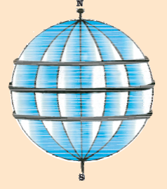
(b) What is a globe?
Answer
A globe is a spherical representation of the Earth, usually made of a map surface that accurately depicts the continents, countries, oceans, and other geographic features, providing a three-dimensional perspective.
(c) What is the latitudinal value of the Tropic of Cancer?
Answer
The latitudinal value of the Tropic of Cancer is approximately 23.5 degrees north.
(d) What are the three heat zones of the Earth?
Answer
The three heat zones of the Earth are the Torrid Zone (between the Tropic of Cancer and the Tropic of Capricorn), the Temperate Zones (between the Tropic of Cancer and the Arctic Circle, and between the Tropic of Capricorn and the Antarctic Circle), and the Frigid Zones (near the poles).
(e) What are the parallels of latitude and meridians of longitude?
Answer
Parallels of latitude are imaginary lines that run parallel to the equator, measuring distances north or south. Meridians of longitude are imaginary lines that run from the North Pole to the South Pole, measuring distances east or west.
(f) Why does the torrid zone receive the maximum amount of heat?
Answer
The Torrid Zone receives the maximum amount of heat because it lies near the equator, where the sun’s rays are more direct throughout the year, resulting in higher temperatures and more intense sunlight.
(g) Why is it 5.30 p.m. in India and 12.00 noon in London?
Answer
The time difference between India and London is due to the variation in their longitudinal positions. As India is located east of London, it experiences earlier hours, resulting in a time difference of approximately 5.5 hours.
Tick the correct answers
(a) The value of the prime meridian is
(i) 90°
(ii) 0°
(iii) 60°
Answer: (ii) 0°
(b) The frigid zone lies near
(i) the Poles
(ii) the Equator
(iii) the Tropic of Cancer
Answer: (i) the Poles
(c) The total number of longitudes are
(i) 360
(ii) 180
(iii) 90
Answer: (i) 360
(d) The Antarctic Circle is located in
(i) The Northern hemisphere
(ii) the Southern hemisphere
(iii) the Eastern hemisphere
Answer: (ii) the Southern hemisphere
(e) Grid is a network of
(i) parallels of latitudes and meridians of longitudes
(ii) the Tropic of Cancer and the Tropic of Capricorn
(iii) the North Pole and the South Pole
Answer: (i) parallels of latitudes and meridians of longitudes
Fill in the blanks
(a) The Tropic of Capricorn is located at approximately 23.5 degrees south.
(b) The Standard Meridian of India is 82.5 degrees east.
(c) The 0° Meridian is also known as the Prime Meridian.
(d) The distance between the longitudes decreases towards the poles.
(e) The Arctic Circle is located in the Northern Hemisphere.
Things to Do
Draw a diagram of the globe showing the Earth’s axis, the Equator, the Tropics
of Cancer and Capricorn, Arctic Circle, and Antarctic Circle.
Answer
Conclusion
Thus, in conclusion, all the answers of model activity task class 6 Geography part 2 are given clearly and to the point. If you prepare these answers and we assure you will get a 100% score in your final exam